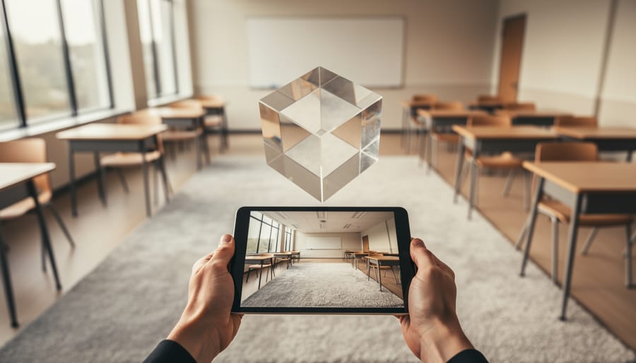



Ask a room of adults to picture a cube, then imagine slicing off one corner with a single flat cut. What shape is the new face? Some people answer instantly: a triangle. Others squint, rotate their hands in the air, and still aren’t sure. Ask the same people to imagine walking out of their front door, turning left, then right, and describe what they’d see, and you’ll get the same split.
That difference is spatial thinking: the ability to hold, transform, and reason about shapes, positions, distances, and movement in your mind. It’s one of the most thoroughly studied abilities in cognitive psychology, one of the strongest predictors of who goes on to succeed in science, technology, engineering, and mathematics, and, surprisingly, one of the least explicitly taught skills in most school systems.
This article looks at spatial intelligence from several angles at once: the psychology of how it’s defined and measured, the neuroscience of where it lives in the brain, the education research showing it can be trained, and the practical question of how to teach it. Running through all of that is one specific tool that hasn’t received much attention in classrooms yet: virtual staging, the software real estate agents use to digitally furnish empty rooms.
It took a full month to write this Teacher guide and a lot of effort alltogether: as you’ll see there is a lot of scientific research baked in this long guide for teachers/tutors and educator staff and school Places, so I’d be grateful if you shared this too on social media and networks!
That might seem like an odd pairing. But virtual staging asks users to do almost exactly what spatial-skills researchers have spent decades trying to train: look at a two-dimensional photograph, understand the three-dimensional space it represents, imagine objects in that space at the right scale and angle, and then compare what they imagined with what the software produces. It’s a perspective-taking, scale-reasoning, and mental-transformation exercise disguised as interior design.
The sections below build from the science to the classroom, covering elementary, middle, and high school separately, and end with coding projects that let students build their own simple “staging” tools.
Part 1: What Spatial Intelligence Actually Is
Gardner’s “spatial intelligence” and why the term stuck
The phrase spatial intelligence became popular through Howard Gardner’s 1983 book Frames of Mind, which proposed the theory of multiple intelligences. Gardner argued that human intelligence isn’t a single general ability but a set of relatively independent capacities: linguistic, logical-mathematical, musical, bodily-kinesthetic, interpersonal, intrapersonal, spatial, and later naturalistic. He described spatial intelligence as the capacity to perceive the visual world accurately, transform those perceptions, and recreate aspects of visual experience even without the original stimulus. His examples included sailors navigating without instruments, sculptors, architects, and chess players.
The theory was enormously influential in schools, especially in the 1990s and 2000s. It’s also important to be honest about its scientific standing. Most cognitive psychologists don’t accept multiple intelligences as a well-supported theory. Critics, including Lynn Waterhouse in a widely cited 2006 review, have pointed out that the intelligences haven’t been validated as separate abilities with distinct measures, and that many of them correlate with general cognitive ability. The related idea of “learning styles,” teaching visual learners visually and auditory learners verbally, has fared even worse: a 2008 review by Harold Pashler and colleagues in Psychological Science in the Public Interest found almost no rigorous evidence that matching instruction to a preferred style improves learning.
So why use the term at all? Because the specific ability Gardner called spatial intelligence is real, measurable, and important. It just fits better in a different framework. Psychometric research going back to the early twentieth century, including large factor-analytic studies such as John Carroll’s 1993 survey of more than 460 datasets, consistently finds a distinct spatial or “visual-spatial” ability factor, separate from (though correlated with) verbal and mathematical reasoning. In that research tradition, spatial ability isn’t an alternative to general intelligence. It’s one of its major components.
That distinction matters for teachers. The useful message isn’t “some children are spatial learners and should be taught differently.” It’s “all children use spatial reasoning, they vary widely in it, and it improves with practice.”
Types of spatial skill
“Spatial ability” isn’t one thing either. Researchers break it down in several ways. One of the most useful frameworks for education comes from Nora Newcombe, Thomas Shipley, and colleagues, and was used as the organizing structure in David Uttal’s major 2013 meta-analysis of spatial training. It sorts spatial skills along two dimensions:
Intrinsic versus extrinsic. Intrinsic skills concern the shape and structure of a single object: its parts, how they fit together, how it looks when rotated. Extrinsic skills concern relationships between objects, or between objects and a frame of reference such as a room, a map, or the viewer’s own body.
Static versus dynamic. Static skills involve recognizing or encoding something as it is. Dynamic skills involve transforming it mentally: rotating, folding, cutting, moving, or changing viewpoint.
That gives four categories:
- Intrinsic-static: recognizing a shape hidden in a complex figure, or identifying the parts of an object.
- Intrinsic-dynamic: mental rotation, mentally folding a paper net into a cube, imagining a cross-section.
- Extrinsic-static: understanding where things are in relation to each other, reading a map, judging whether lines are parallel.
- Extrinsic-dynamic: perspective-taking (what does this scene look like from over there?), navigating, imagining how relationships change when things move.
Another distinction, emphasized by Mary Hegarty and David Waller, separates small-scale spatial ability (manipulating objects you could hold or see all at once, like puzzle pieces) from large-scale spatial ability (navigating environments you have to move through, like a building or a city). The two are related but not identical. Someone can be excellent at mental rotation tests and still get lost in a parking garage.
Virtual staging is interesting precisely because it touches almost all of these. Recognizing the corners and edges of a room in a photograph is intrinsic-static. Imagining a sofa rotated to fit against a wall is intrinsic-dynamic. Judging whether a table fits between a window and a door is extrinsic-static. Imagining the room from the doorway versus from the window is extrinsic-dynamic. And the whole task is a bridge between small-scale reasoning (the image on a screen) and large-scale reasoning (a room you could walk through).
How spatial ability is measured
A few classic tests appear again and again in the research, and they’re useful to know because many classroom activities are simplified versions of them:
- Mental rotation tasks. The landmark study is Roger Shepard and Jacqueline Metzler’s 1971 paper in Science. Participants saw pairs of 3D block figures and decided whether they were the same object rotated or mirror images. The striking result was that response time increased in a nearly straight line with the angle of rotation, as if people were literally turning the object in their minds at a steady speed. The Vandenberg and Kuse Mental Rotations Test (1978), based on those figures, became one of the most widely used spatial tests in the world.
- Paper folding tests. Participants see a sheet of paper folded several times with a hole punched through it, and must predict the pattern of holes when it’s unfolded.
- Purdue Spatial Visualization Test: Rotations (PSVT:R). Common in engineering education research, it asks people to apply a rotation shown on one object to another object.
- Perspective-taking tests. Participants imagine standing at one object in a scene, facing another, and indicate the direction of a third.
- Embedded figures and block design tasks. Finding a simple shape hidden in a complex one, or reproducing a pattern with colored blocks.
Notice that none of these are tests of artistic talent. They’re tests of mental modeling, holding a structure in mind and operating on it.
Part 2: The Neuroscience of Seeing Space
Two pathways for vision
When light hits the retina and signals reach the visual cortex at the back of the brain, the processing splits roughly into two streams. This model, developed by Leslie Ungerleider and Mortimer Mishkin in the early 1980s and refined by Melvyn Goodale and David Milner in the 1990s, is often summarized as “what” versus “where” (or “how”).
- The ventral stream runs down toward the temporal lobes and is heavily involved in recognizing objects: this is a chair, that’s a face, this is a cup.
- The dorsal stream runs up toward the parietal lobes and is heavily involved in spatial location, movement, and guiding action: the chair is to my left, the cup is within reach, my hand needs to rotate to grab the handle.
The two streams interact constantly, and the “what/where” split is a simplification. But it gives teachers a useful mental picture. Recognizing that a picture shows a living room draws heavily on ventral processing. Figuring out where a bookshelf would fit, how deep the room is, and how a couch would look from a different angle draws heavily on dorsal and parietal processing.
The parietal cortex and mental rotation
Brain imaging studies of mental rotation consistently show activity in the parietal cortex, particularly the superior parietal lobule and the intraparietal sulcus. A 2008 meta-analysis of neuroimaging studies by Jeffrey Zacks in the Journal of Cognitive Neuroscience found that mental rotation reliably engages posterior parietal regions, along with areas involved in planning movement.
That second finding is a useful one for teachers. Mental rotation seems to recruit some of the same systems the brain uses to plan physical action. When you imagine rotating an object, parts of the brain behave as though you might be about to rotate it with your hands. This is one reason gestures matter in spatial learning: research by Susan Goldin-Meadow, Susan Levine, and colleagues has shown that children who gesture while solving spatial and mathematical problems often perform better, and that teaching gestures can help children learn.
The intraparietal sulcus is also strongly involved in number processing, including estimating quantities and comparing magnitudes. Stanislas Dehaene and colleagues have argued that numbers are partly represented spatially in the brain, often along a mental “number line.” The overlap between spatial and numerical processing in the parietal cortex is one of the leading explanations for why spatial skill and mathematical skill are so closely linked. More on that in Part 3.
Place cells, grid cells, and the brain’s map
Large-scale spatial ability, knowing where you are and how to get somewhere, relies heavily on a different set of structures in the medial temporal lobe, especially the hippocampus and the entorhinal cortex.
In 1971, John O’Keefe and Jonathan Dostrovsky discovered neurons in the rat hippocampus that fired only when the animal was in a particular location. These became known as place cells. Decades later, in 2005, May-Britt Moser and Edvard Moser discovered grid cells in the nearby entorhinal cortex, neurons that fire in a regular, repeating triangular pattern as an animal moves through space, acting something like a coordinate system. O’Keefe and the Mosers shared the 2014 Nobel Prize in Physiology or Medicine for discovering what was described as the brain’s positioning system.
In humans, a region called the parahippocampal place area, identified by Russell Epstein and Nancy Kanwisher in 1998, responds especially strongly to images of scenes and places, such as rooms, landscapes, and buildings, more than to individual objects or faces. That’s directly relevant to virtual staging: looking at a photograph of a room and imagining what’s in it engages scene-processing systems the brain uses to understand environments.
Experience changes the spatial brain
Perhaps the most famous study in spatial neuroscience is Eleanor Maguire’s research on London taxi drivers. To get a license, London cabbies must memorize “The Knowledge,” a map of roughly 25,000 streets and thousands of landmarks, a process that typically takes years. In a 2000 study published in the Proceedings of the National Academy of Sciences, Maguire and colleagues used MRI to compare 16 licensed taxi drivers with control participants. The drivers had larger posterior hippocampi, and the size of that region correlated with how long they had been driving taxis.
A correlation doesn’t prove causation on its own: perhaps people with larger hippocampi are drawn to cab driving. So in a later longitudinal study, published in 2011 in Current Biology, Katherine Woollett and Maguire followed trainee drivers over about four years. Trainees who passed the exam showed growth in posterior hippocampal gray matter. Those who failed or quit, and control participants, did not.
The lesson isn’t that teachers should make students memorize 25,000 streets. It’s that the spatial brain is plastic. Sustained, demanding spatial experience produces measurable changes, even in adults.
Imagery, memory, and the “mind’s eye”
Spatial thinking also overlaps with mental imagery, the ability to generate and inspect pictures in your mind. Stephen Kosslyn’s research from the 1970s onward showed that people scan mental images in ways that resemble scanning real ones: in classic experiments, the time it took people to mentally travel between two points on an imagined map increased with the distance between them.
Allan Paivio’s dual coding theory, first developed in the 1970s, proposes that the mind uses two partly separate systems: one for verbal information and one for imagery. Information encoded both ways, such as a word paired with a picture, tends to be remembered better than information encoded only one way. This is one of the foundations of modern advice to combine words and visuals in teaching.
John Sweller’s cognitive load theory adds a caution. Working memory is limited. Visuals help when they reduce unnecessary effort, for example a diagram that shows a relationship instantly instead of three paragraphs that describe it. They hurt when they add clutter or force students to split attention between disconnected sources. That’s a principle worth remembering when using rich, busy tools like virtual staging: the goal is to make spatial relationships easier to see, not to overwhelm students with decorative detail.
Part 3: Why Spatial Skills Matter So Much
The STEM pipeline
The strongest evidence for the importance of spatial ability comes from very long, very large studies.
Project TALENT began in 1960 and tested about 400,000 American high school students in grades 9 through 12 on a wide range of abilities, then followed them into adulthood. In a 2009 paper in the Journal of Educational Psychology, Jonathan Wai, David Lubinski, and Camilla Benbow analyzed those data along with other longitudinal studies spanning more than 50 years. Their conclusion: spatial ability measured in adolescence predicted later achievement in STEM fields, including the choice of STEM majors, STEM degrees, and STEM careers, even after accounting for mathematical and verbal ability. Columbia university developed some special puzzles to help children spatial skills as well.
That last point is crucial. Spatial ability isn’t just a proxy for being good at math. It adds predictive power on top of math and verbal scores. Related work from the Study of Mathematically Precocious Youth, which follows students identified as highly gifted, found that spatial ability added meaningful predictive information about who would go on to creative and scientific accomplishments, including publications and patents.
Wai and his colleagues also made a point with direct implications for schools. Many students with exceptional spatial ability don’t stand out on standard math and verbal tests. Because most talent searches and gifted programs rely heavily on those tests, a large share of spatially talented students may be overlooked. These students may be especially likely to thrive in engineering, architecture, physical sciences, and skilled technical trades, but nobody tells them so.
The connection to mathematics
The link between spatial skill and math shows up early. Research by Kelly Mix, Yi-Ling Cheng, and colleagues has found that spatial skills and mathematical skills are strongly related in young children, and in some analyses spatial and math abilities look almost like a single factor in the early elementary years.
Some of the most interesting evidence comes from training studies. In a 2014 study published in the Journal of Cognition and Development, Cheng and Mix gave six- to eight-year-olds a single 40-minute session of mental rotation practice, using physical puzzles and shapes. Compared with a control group that did crossword puzzles, the children who practiced mental rotation improved not only on spatial tasks but on calculation, especially “missing term” problems such as 4 + __ = 9. One explanation is that those problems require rearranging the parts of an equation mentally, a kind of spatial manipulation.
Elizabeth Gunderson, Gerardo Ramirez, Sian Beilock, and Susan Levine found in 2012 that first and second graders’ spatial skills predicted their later understanding of the number line and their approximate calculation skills. The number line connection again points to that parietal overlap between space and number.
Larger meta-analyses have since pulled this evidence together. In 2022, Zachary Hawes, Katie Gilligan-Lee, and Kelly Mix published a meta-analysis in Developmental Psychology examining spatial training studies involving about 3,700 participants aged 3 to 20. They found that spatial training can improve mathematics performance, and that hands-on training with physical materials such as blocks and puzzles appeared more effective than purely digital training. That finding is important for anyone thinking about virtual staging in classrooms, and it’s a theme that comes back in the lesson design sections below: digital tools work best when combined with physical measurement and manipulation, not as a replacement for them.
Spatial skills can be trained
For teachers, the single most important research finding is that spatial skills aren’t fixed.
The landmark study here is David Uttal and colleagues’ 2013 meta-analysis in Psychological Bulletin, titled “The Malleability of Spatial Skills.” It combined results from 217 training studies. The average effect of spatial training compared with control groups was a Hedges’s g of 0.47, a moderate effect by conventional standards and a substantial one for an educational intervention. Three further findings made the result especially useful:
- The gains lasted. Effects didn’t fade noticeably when there was a delay between training and testing.
- The gains transferred. Training on one kind of spatial task improved performance on other, untrained spatial tasks.
- Many kinds of training worked, including video games, semester-long courses, and practice on specific spatial tasks.
A 2020 meta-analysis in Frontiers in Psychology by Weipeng Yang and colleagues focused specifically on young children, aged 0 to 8. Across 20 intervention studies from 2009 to 2020, with about 900 children in training groups and 635 in control groups, it found an average effect of g = 0.96, roughly twice the effect reported for the broader age range in Uttal’s study. Small numbers of studies can inflate effect sizes, so that figure should be treated cautiously, but it suggests early childhood may be an especially responsive period.
Engineering students and the cost of not teaching it
One of the clearest real-world examples comes from engineering education. Sheryl Sorby, an engineering professor at Michigan Technological University, began studying first-year students who struggled with spatial visualization in the 1990s. Students who failed a spatial test at entry were offered a course in spatial skills, covering sketching, rotations, cross-sections, and orthographic projections. Over many years of follow-up studies, Sorby reported that students who took the course improved substantially on spatial tests and were more likely to stay in engineering, with the effect especially pronounced for women.
The implication is a little uncomfortable. If a few weeks of explicit spatial instruction can change who stays in engineering at age 18, many students are probably being filtered out of STEM long before then by a skill no one ever explicitly taught them.
Gender, experience, and spatial anxiety
Gender differences in spatial ability have been studied extensively. Meta-analyses by Marcia Linn and Anne Petersen in 1985 and by Daniel Voyer, Susan Voyer, and Philip Bryden in 1995 found that average male advantages are largest on mental rotation tasks and much smaller or absent on many other spatial measures. The size of these differences varies across studies, tasks, and cultures, and the causes are debated, with researchers pointing to a mix of possible biological factors and differences in experience, such as play with construction toys, video games, sports, and navigation.
Two findings stand out for teachers. First, according to Uttal’s meta-analysis, boys and girls improve with training at similar rates. Second, some interventions have narrowed the gap. In a 2007 study in Psychological Science, Jing Feng, Ian Spence, and Jay Pratt found that about 10 hours of playing an action video game improved spatial attention and mental rotation, and that women improved more than men, substantially reducing the gender difference. Training is not a fix for every inequity, but it’s strong evidence that experience matters a great deal.
There’s also an emotional side to spatial thinking. Research on spatial anxiety, feeling nervous or incompetent when asked to navigate, rotate, or visualize, has found that it relates to lower spatial performance. Gerardo Ramirez and colleagues found in a 2012 study that spatial anxiety was present in children as young as first and second grade, and that it was associated with weaker mental rotation performance, particularly among children with higher working memory capacity, the very children who might otherwise be expected to do well. Children who believe they’re “just bad at directions” or “not a visual person” may avoid exactly the kind of practice that would help them improve.
This is where the framing matters. A low-stakes, playful activity, like designing a bedroom on a photo, may give anxious students a way to practice spatial reasoning without feeling tested.
Early experience: blocks, puzzles, and spatial words
Some of the most practical research focuses on everyday experiences in early childhood:
- Puzzles. Susan Levine and colleagues found in a 2012 study in Developmental Psychology that toddlers who played with puzzles more often between ages 2 and 4 performed better on a mental transformation task at around 4½, even after controlling for parents’ income and education.
- Blocks and construction. Studies by Brian Verdine, Roberta Golinkoff, Kathy Hirsh-Pasek, and colleagues have found that preschoolers’ ability to copy block structures predicts later math achievement. Research reviewed by Nora Newcombe has linked block and LEGO play in early childhood to later math performance.
- Spatial language. Shannon Pruden, Susan Levine, and Janellen Huttenlocher found in a 2011 study that children whose parents used more spatial words, such as above, below, corner, edge, curvy, and triangle, during everyday interactions performed better on spatial tasks later on. Words give children tools to notice and talk about spatial relationships.
These findings suggest a simple idea: spatial ability grows through rich experience with shapes, space, and spatial language. Virtual staging can add one more kind of experience, especially for older children, connecting the flat image on a screen with the real three-dimensional room around them.
Part 4: What Virtual Staging Is, and Why It’s a Spatial Tool
A short definition
Virtual staging is the process of digitally adding furniture, decor, and finishes to a photograph of a real space. It began in residential real estate as a cheaper alternative to physical staging, which means renting and moving real furniture into a home for sale. Instead, an agent photographs an empty room, and a designer or software places realistic sofas, rugs, beds, plants, and artwork into the image.
The idea caught on because it helps people imagine. The National Association of REALTORS® reported in its 2025 Profile of Home Staging that 83% of buyers’ agents said staging made it easier for buyers to visualize a property as their future home. That’s a striking statement in cognitive terms. Many adults struggle to mentally furnish an empty room, which is, at its core, a spatial visualization problem: the 2026 Best Virtual Staging Software here (as with many modern AI Virtual Staging Software Apps for Real Estate and Realtors) can help visualize every House!
Today the term covers several kinds of tools:
- Human-edited staging, where a designer uses 3D models and photo editing software to insert objects realistically.
- AI staging, where a user uploads a photo, selects a room type and style, and the software generates furnished versions in seconds.
- 3D room planners, where users build a room from measurements and place furniture in a model they can view from any angle.
- Augmented reality apps, which overlay virtual furniture on a live camera view of a real room.
For classroom use, the distinctions matter. AI staging is fast and impressive but does much of the spatial reasoning for the user. 3D planners and AR apps require more active spatial decisions. The richest learning comes from combining them: students make their own predictions and plans first, then use software to generate or test a version, then compare the result with their predictions and with the real room.
What the brain has to do to “stage” a room
It’s worth breaking down what a person actually does, cognitively, when they look at an empty room photo and imagine it furnished:
- Reconstruct 3D space from a 2D image. The brain has to infer depth from cues like converging lines, the size of known objects, shading, and where walls meet the floor. This is a perceptual skill most adults do automatically, but it’s surprisingly complex. Young children’s understanding of how pictures represent 3D space develops gradually.
- Establish scale. How big is the room? Is that window three feet wide or six? People estimate scale from familiar objects, such as doors, light switches, and outlets. Without them, scale judgments become difficult.
- Place and rotate objects mentally. Where would the bed go? Which way should it face? Would it block the door? This is mental rotation and spatial relations reasoning.
- Take perspectives. What would the room look like from the doorway, or from the bed? Perspective-taking is an extrinsic-dynamic skill, and research on children’s development, going back to Jean Piaget and Bärbel Inhelder’s famous “three mountains” task, shows it develops slowly.
- Check constraints. Does the furniture fit? Is there room to walk? Is the scale believable? This is reasoning about measurement, area, and proportion.
- Compare imagined and generated results. When the software produces an image, users judge whether it “looks right,” noticing errors in scale, perspective, or placement.
That last step is where much of the learning can happen. AI-generated images are often not quite right. A table might be too small, a rug might float slightly above the floor, or a chair might have a perspective that doesn’t match the room. Spotting those errors requires exactly the spatial understanding teachers want to build.
Why it’s especially useful for teaching
There are several reasons virtual staging fits well with what research says about spatial learning:
It connects small-scale and large-scale space. Most spatial exercises in school are small-scale, using shapes on paper or blocks on a desk. Virtual staging uses images of real rooms, including the classroom itself, so students can move between the photo, a floor plan, and the actual physical space.
It’s naturally motivating. Designing a bedroom, a classroom reading corner, or a dream treehouse interior is more engaging for many students than rotating abstract block figures.
It makes predictions visible. Students can sketch their plan, predict what will fit, and then check. Research on learning generally supports this kind of prediction and feedback cycle.
It offers multiple representations. A single project can involve a photo, a hand-drawn floor plan, a scale drawing, a 3D model, measurements, and a written explanation. This aligns with dual coding and multiple representation research.
It invites spatial language. Talking about where to put things, beside, behind, across from, facing, parallel to, diagonal, naturally builds the spatial vocabulary Pruden and colleagues found important.
It’s a gateway to media literacy. Students who have edited a room photo themselves understand, at a gut level, that images can be altered convincingly.
An important caution: digital isn’t always better
The 2022 Hawes, Gilligan-Lee, and Mix meta-analysis found that physical, hands-on spatial training appeared more effective for mathematics than digital training. That should shape how virtual staging is used. Software works best as one stage in a cycle that includes physical measurement, drawing, model-building, and walking through the real space, not as a screen-only replacement for those experiences.
There’s also a risk of what might be called “spatial outsourcing.” If AI does all of the arranging, students may simply watch rather than reason. Good lesson design puts the student’s mind to work before the software does.
Part 5: A Design Framework for Spatial Lessons
Before getting into grade-specific lessons, it helps to have a general structure. The following cycle is based on established principles from spatial cognition research and learning science, adapted for visualization tools. It can be scaled up or down for different ages.
The Predict, Plan, Stage, Compare, Reflect cycle
1. Predict. Students look at a photo of an empty or partly empty room and make predictions. How wide is the room? Will a bed fit along that wall? What will the room look like from the door? Predictions activate prior knowledge and make later feedback meaningful.
2. Plan. Students draw a floor plan or sketch, using measurements where appropriate. This is where much of the spatial reasoning happens: translating between the photo, the bird’s-eye view, and real measurements.
3. Stage. Students use virtual staging software, a 3D room planner, an AR app, or even cut-out paper furniture on a printed photo to create their design.
4. Compare. Students compare their prediction, their plan, and the staged image. Does the furniture look the right size? Are the angles correct? Does the AI version match the floor plan? Where possible, they check against the real room.
5. Reflect. Students explain what surprised them, what was hard to visualize, and what they’d change. Reflection helps learners notice their own reasoning, a process often called metacognition.
Principles to build in
- Use physical materials too. Tape measures, graph paper, blocks, and cardboard models anchor digital work in real space.
- Gesture freely. Encourage students to use their hands to show rotations and directions. Research on gesture and spatial learning supports this.
- Name spatial relationships out loud. Teachers can model spatial vocabulary deliberately.
- Vary viewpoints. Have students draw the same room from above, from the door, and from a corner.
- Keep cognitive load manageable. Start with simple rooms and few objects. Add complexity gradually.
- Make errors interesting. When an AI image has a mistake, treat it as a puzzle to solve, not a failure.
- Keep it low-stakes. Especially for students with spatial anxiety, design projects should feel like exploration, not testing.
Part 6: Elementary School (Grades K–5)
Developmental context
Children’s spatial understanding changes dramatically during the elementary years. Younger children often find it difficult to imagine a scene from another person’s viewpoint, a finding first documented in Piaget and Inhelder’s work and refined by many later researchers who showed that children can take simple perspectives earlier than Piaget thought, especially with familiar settings. Understanding maps and scale models also develops during early childhood. Judy DeLoache’s research showed that very young children often struggle to understand that a scale model represents a real room, a concept she called “dual representation,” since a model is both an object and a symbol for something else.
That research is directly relevant to virtual staging. A photo of a room is a representation of a room. For young children, connecting the image to the real space is itself a learning goal.
Elementary math standards in many countries also include spatial content: describing positions using words like above, below, beside, and between; identifying 2D and 3D shapes; composing shapes; measuring length; understanding area as covering a space with unit squares; and, by the upper grades, working with coordinate grids and volume. In the United States, the Common Core State Standards include these across grades K–5, and similar content appears in curricula worldwide.
Lesson idea 1: Where does it go? (Grades K–1)
Goal: Build spatial vocabulary and connect a picture to a real space.
Activity:
- Take a photo of a familiar space, such as the classroom reading corner, with some objects removed.
- Print it large or display it on a screen.
- Give children paper cut-outs of objects such as a rug, a beanbag, a bookshelf, and a plant.
- Ask them to place the objects and describe where they go: “The plant is next to the window.” “The rug is in front of the bookshelf.”
- Then go to the real reading corner and arrange real objects the same way. Compare.
Spatial skills: spatial language, extrinsic-static relationships, connecting representations to real space.
Why it works: It’s based on spatial language research and on DeLoache’s work showing that young children benefit from explicit connections between a representation and what it stands for.
Lesson idea 2: The room from above (Grades 1–2)
Goal: Introduce the bird’s-eye view, an early step toward maps and floor plans.
Activity:
- Place a few blocks or toy furniture on a tabletop “room” made from a shoebox.
- Have children draw what they see from the side.
- Then have them stand over it and draw it from above.
- Show a photo of a real room and a simple floor plan of the same room. Ask: What’s the same? What’s different?
- Finally, have them draw a floor plan of their own bedroom from memory.
Spatial skills: perspective-taking, translating between viewpoints, early map skills.
Extension: Use a free 3D room planner to show the same room from above and from inside, toggling between views.
Lesson idea 3: How many squares? (Grades 2–3)
Goal: Connect area to real rooms.
Activity:
- Use masking tape to mark a rectangle on the classroom floor, such as 6 feet by 4 feet.
- Have students cover it with one-foot paper squares and count them.
- Show a photo of a small empty room and its floor plan on graph paper, where each square represents one foot.
- Ask students to “stage” the room by drawing rectangles for furniture on the grid: a bed covers 3 × 6 squares, a desk covers 2 × 4.
- Ask: How many squares are left for walking around?
Spatial and math skills: area as unit squares, scale, part-whole reasoning.
Why it works: Area is one of the concepts students most often learn as a formula without understanding. Covering a real space with real squares makes it concrete. Linking it to a room design gives it purpose.
Lesson idea 4: Spot the mistake (Grades 3–5)
Goal: Practice visual analysis and introduce the idea that images can be altered.
Activity:
- Prepare a few virtually staged images, some created carefully and some with obvious errors: a chair floating above the floor, a table that’s far too small, a lamp casting a shadow in the wrong direction, a bed blocking a door.
- Ask students to find what looks wrong and explain why.
- Discuss: How can you tell something’s too big or too small? What clues help you judge size in a photo?
Spatial skills: scale estimation, perspective cues, shadow and light reasoning.
Media literacy connection: Explain that some photos online have been changed, and that real estate pictures are sometimes digitally furnished. Ask: Is it okay to change a photo? When should people tell you a photo was changed?
Lesson idea 5: Design a classroom corner (Grades 4–5)
Goal: A complete design project combining measurement, scale drawing, and digital staging.
Activity:
- Predict: Students look at a photo of an underused corner of the classroom and predict its dimensions.
- Measure: They measure the real space with tape measures and record lengths.
- Plan: They create a scale floor plan on graph paper (for example, one square equals six inches) and decide what to include, such as a reading nook, a science station, or a quiet desk.
- Stage: Using virtual staging software, a room planner, or printed photos with cut-out furniture, they create a visual of their design.
- Compare: They check whether furniture sizes in the image match their floor plan and measurements.
- Reflect: They write or present a short explanation: what they designed, why, and what was hardest to imagine.
- Optional real-world step: The class votes, and the winning design is actually built.
Skills: measurement, area, perimeter, scale, spatial visualization, communication, collaboration.
Teacher tip: Building the design for real gives the most powerful feedback loop. Students see whether what they imagined matches reality.
Assessment ideas for elementary
- Ask students to draw a floor plan of the classroom from memory and compare it with an accurate plan.
- Use simple paper-folding or mental rotation puzzles before and after a unit.
- Listen for spatial vocabulary in student explanations.
- Evaluate scale drawings for accurate relative sizes.
Part 7: Middle School (Grades 6–8)
Developmental context
Middle schoolers are generally ready for more abstract spatial reasoning: working with ratios and scale factors, interpreting cross-sections, reasoning about surface area and volume, and representing 3D objects in 2D drawings. These topics appear in most middle school math curricula. In the Common Core, for example, seventh graders solve problems involving scale drawings and describe cross-sections of 3D figures, and eighth graders work with transformations such as rotations, reflections, and translations on the coordinate plane.
This is also a period when many students begin to decide whether they’re “math people” or “science people.” Given the research on spatial ability and STEM persistence, middle school may be one of the most valuable times to build spatial confidence.
Lesson idea 6: Scale drawings and real rooms (Grade 7)
Goal: Master scale factors using real spaces.
Activity:
- Students measure a real room at school, such as the classroom, library, or a small office, and record its dimensions.
- They create a scale drawing at 1:50 (or ¼ inch = 1 foot).
- They “furnish” it on paper using furniture with real dimensions, which they look up or measure.
- They then photograph the empty or rearranged room and use virtual staging software to create an image of their design.
- Key comparison: Is the furniture in the staged image consistent with the scale drawing? If the software makes a desk look twice as large as it should be, can students prove that using the scale?
Math connections: proportional reasoning, scale factor, unit conversion, area.
Extension: Change the scale factor and redraw. Discuss how area changes when length scales by a factor of 2 (area scales by 4). This is a classic misconception that becomes obvious when students see that doubling a room’s length and width quadruples its floor space.
Lesson idea 7: Transformations in a room (Grade 8)
Goal: Connect rotations, reflections, and translations to physical arrangement.
Activity:
- Students place furniture shapes on a coordinate grid representing a room.
- They apply transformations: rotate the bed 90° around its corner, reflect the room layout across a centerline, translate the bookshelf three units right.
- They predict the new layout before drawing it.
- They test their predictions in a 3D room planner or virtual staging tool, then check whether the image matches.
Spatial skills: mental rotation, reflection, coordinate reasoning.
Why it works: Transformations are often taught as abstract rules applied to points. Applying them to a room makes the result meaningful: “If I rotate the desk, will it still fit?”
Lesson idea 8: Same room, different viewpoints (Grades 6–8)
Goal: Build perspective-taking.
Activity:
- Show a photo of a room taken from the doorway.
- Ask students to sketch what the same room would look like from the far corner, or from above.
- Then show actual photos from those viewpoints, or generate them using a 3D room planner.
- Compare sketches with real views.
Spatial skills: extrinsic-dynamic reasoning, perspective-taking, mental imagery.
Science connection: In science classes, the same skill helps with interpreting diagrams of the Earth, Moon, and Sun from different viewpoints, a topic many students find confusing.
Lesson idea 9: Light, shadow, and believable images (Grades 6–8)
Goal: Connect physics of light with visual analysis.
Activity:
- Students observe how shadows in a classroom change throughout the day.
- They examine staged images and decide whether shadows in them are consistent with the light sources shown, such as windows or lamps.
- They draw arrows on the image from light sources to objects to shadows.
Connections: the physics of light traveling in straight lines, spatial reasoning, and media literacy. Shadow inconsistencies are one of the clues forensic image analysts use to detect manipulated photos.
Part 8: High School (Grades 9–12)
Developmental context
High school students can handle sophisticated spatial reasoning: 3D coordinate geometry, trigonometry, vectors, technical drawing, and the mathematics of perspective. They’re also capable of genuine design work and critical analysis of technology. This is the stage where virtual staging can connect to geometry, physics, computer graphics, architecture, engineering, art, and AI ethics.
Lesson idea 10: The geometry of perspective (Geometry, Art)
Goal: Understand how 3D space is represented on a 2D image.
Activity:
- Students learn the basics of linear perspective: horizon line, vanishing points, and how parallel lines converge in images. This draws on the Renaissance discoveries of Filippo Brunelleschi and Leon Battista Alberti.
- They take photos of rooms and draw lines along floor edges, ceiling edges, and furniture edges to find the vanishing points.
- They analyze virtually staged images: Do the edges of inserted furniture converge on the same vanishing points as the room? If not, the furniture will look “off.”
- They hand-draw a piece of furniture into a room photo using correct perspective.
Skills: projective geometry, analytic reasoning, technical drawing.
Why it works: It reveals how virtual staging software must solve a real geometry problem. To insert an object believably, software has to estimate the camera’s position and the room’s 3D layout from a single photo.
Lesson idea 11: Design a real space (Architecture, Engineering, CTE)
Goal: A complete design project modeled on professional practice.
Activity:
- Teams choose a real space at school that needs improvement, such as a student lounge, a library corner, a hallway alcove, or an outdoor seating area.
- They interview users to understand needs.
- They measure the space and create scaled floor plans and elevations.
- They create multiple design options and use virtual staging and 3D modeling to visualize them.
- They estimate costs, check accessibility requirements such as clear paths for wheelchairs, and consider safety codes.
- They present to an audience, such as school administrators, and gather feedback.
Skills: spatial visualization, measurement, budgeting, design thinking, communication.
Design thinking connection: This follows the familiar design thinking sequence: empathize, define, ideate, prototype, test. Virtual staging is a rapid prototyping tool, letting teams test many ideas cheaply before building anything.
Lesson idea 12: How does AI “see” a room? (Computer Science, AI literacy)
Goal: Understand how image-generating AI works, and where it fails.
Activity:
- Introduce basic concepts: computer vision, depth estimation from single images, segmentation (identifying which pixels belong to the floor, walls, and windows), and generative models.
- Students test AI staging tools with challenging images: unusual angles, odd lighting, very small rooms, rooms with mirrors.
- They catalogue errors: wrong scale, floating objects, warped geometry, furniture blocking doors.
- They discuss why these errors happen. AI models learn patterns from large sets of images rather than reasoning about physical space the way humans do.
Skills: AI literacy, critical thinking, spatial analysis.
Discussion: If AI makes spatial errors humans catch easily, what does that tell us about the difference between pattern recognition and understanding?
Part 9: Media Literacy, Ethics, and Seeing Critically
Spatial education and media literacy overlap more than they seem to. Recognizing that an image has been altered often depends on spatial reasoning: noticing inconsistent shadows, impossible perspectives, mismatched scale, or objects that don’t sit properly on surfaces.
Real estate offers a clear example for discussion. Virtually staged listing photos are common, and some jurisdictions have begun requiring disclosure when listing images are digitally altered. California, for example, passed a law in 2025 requiring disclosure of digitally altered real estate listing photos and access to the originals, beginning in 2026. That makes a good case study for students of any age:
- Elementary: Is it fair to change a picture of a house without telling anyone?
- Middle school: What’s the difference between staging a room to help people imagine it and hiding a problem, such as covering a crack in the wall?
- High school: How should laws handle AI-generated images? Who is responsible if an altered image misleads someone?
Students who have created staged images themselves tend to understand these questions in a more concrete way. They know exactly how easy it is.
A useful classroom habit is a simple four-question check for any image:
- What is shown?
- What might have been added, removed, or changed?
- What clues (shadows, scale, perspective, edges) support or contradict that?
- Who made this image, and why?
Part 10: The Coding Crossover
Turtle geometry and the origins of spatial programming
The link between spatial thinking and coding goes back to the 1960s and 1970s, when Seymour Papert, Wally Feurzeig, Cynthia Solomon, and colleagues developed the programming language LOGO. Its best-known feature was the “turtle,” an on-screen cursor (or a small robot) that children could direct with commands such as FORWARD 50 and RIGHT 90. In his 1980 book Mindstorms, Papert argued that programming the turtle let children explore geometry by “playing turtle,” imagining themselves moving through space and using their own bodies to reason about angles and paths.
That idea, body-syntonic learning in Papert’s phrase, connects directly to the research on embodied cognition and spatial thinking. Today, Python’s built-in turtle module and block-based tools like Scratch carry on the same tradition.
What the research says about spatial skills and programming
The relationship between spatial ability and programming has been an active research area. In a 2018 study presented at the ACM International Computing Education Research conference, Jack Parkinson and Quintin Cutts at the University of Glasgow tested 72 participants, from first-year computing students to PhD students and faculty, on the Revised Purdue Spatial Visualization Test. Spatial scores generally increased with level of achievement in computer science. The authors described the overall evidence on the topic as “tantalising, though not convincing”: there’s a consistent association, but it’s not yet clear whether spatial skills cause better programming, programming builds spatial skills, or both are linked to other factors.
That nuance is worth sharing with students and colleagues. Coding and spatial reasoning seem to support each other, but we shouldn’t overclaim.
Coding projects by level
Elementary (Scratch or block-based):
- Room walker: Students program a sprite to walk around the edges of a room floor plan. They have to figure out lengths and turning angles.
- Furniture placer: Students drag furniture sprites onto a room backdrop and write code that checks whether two pieces overlap (“Is the bed touching the desk?”).
- Grid rooms: Students build a room on a grid and code a character that moves from the door to a target without hitting furniture, an early introduction to path planning.
Middle school (Python turtle or similar):
- Draw a floor plan with code: Students write a program that draws a room and its furniture as rectangles, using real measurements and a scale factor.
- Area calculator: Their program calculates the total floor area, the area taken up by furniture, and the remaining walking space.
- Rotations: Students write a function that rotates a rectangle (a piece of furniture) by 90 degrees and redraws it.
A simple example of the kind of starting code students might write:
import turtle
SCALE = 20 # 20 pixels = 1 foot
def draw_rect(x, y, width_ft, depth_ft, label):
t.penup()
t.goto(x * SCALE, y * SCALE)
t.pendown()
for side in [width_ft, depth_ft, width_ft, depth_ft]:
t.forward(side * SCALE)
t.left(90)
t.penup()
t.goto((x + 0.5) * SCALE, (y + 0.5) * SCALE)
t.write(label)
t = turtle.Turtle()
t.speed(0)
draw_rect(-6, -5, 12, 10, “Room 12 x 10 ft”)
draw_rect(-6, -5, 3, 6.5, “Bed”)
draw_rect(3, 2, 3, 2, “Desk”)
room_area = 12 * 10
furniture_area = (3 * 6.5) + (3 * 2)
print(“Free floor space:”, room_area – furniture_area, “sq ft”)
turtle.done()
This small program brings together scale, coordinates, area, and the visual result of decisions, all core spatial and mathematical ideas.
High school (Python, JavaScript, or 3D tools):
- Collision detection: Students write code that checks whether rectangles overlap, then extend it to check whether a door can swing open without hitting furniture (an arc-and-rectangle problem).
- Simple 3D projection: Using basic trigonometry, students write a program that projects 3D points onto a 2D screen, effectively building a tiny rendering engine. This shows how perspective images are computed and connects directly to the geometry of vanishing points.
- Layout optimizer: Students design an algorithm that tries many furniture arrangements and scores them by free walking space, distance to windows, or clearance around doors, an introduction to search and optimization.
- AI exploration: Advanced students can experiment with open-source image segmentation or depth estimation models to see how software identifies floors and walls in a room photo.
These projects mirror what real virtual staging and room-planning software must do: represent space, detect collisions, project 3D onto 2D, and make placement decisions.
Part 11: Limits, Open Questions, and Honest Caveats
A research-based article should be clear about what isn’t yet known.
No direct studies on virtual staging in classrooms. The research summarized here is about spatial skills, spatial training, and related tools. As of this writing, there’s little or no published research testing virtual staging software specifically as a spatial training tool for students. The argument for it rests on how closely its tasks align with established spatial training approaches, not on direct evidence.
Transfer to math and STEM is real but not automatic. Uttal’s meta-analysis found that spatial training transfers to other spatial tasks. Hawes and colleagues found that spatial training can improve math. But how much gain transfers depends on the type of training, its duration, and how explicitly teachers connect spatial work to math concepts.
Physical experience matters. Evidence suggests hands-on training may be more effective than digital training for math outcomes. Virtual staging should complement, not replace, physical activities.
AI can do the thinking for students. If software arranges everything automatically, students may learn little. Lessons need to require predictions, plans, and critical comparisons.
Equity of access. Not every school has devices, software licenses, or reliable internet. Many of the activities above can be done with printed photos, paper cut-outs, and graph paper. The thinking matters more than the tool.
Privacy. Photos of students’ homes or bedrooms can reveal personal information. Classroom projects should use school spaces, stock images of empty rooms, or images families have chosen to share.
Conclusion: Teaching Children to See Space
Spatial thinking sits quietly underneath a remarkable range of human activity: reading a map, packing a suitcase, understanding a graph, solving an equation, designing a bridge, writing a program that draws a shape, or simply arranging a bedroom. Decades of research show that it predicts who goes on to succeed in science and engineering, that it’s closely tied to mathematical understanding, that it lives in brain systems that change with experience, and, most importantly, that it can be taught.
Yet most schools don’t teach it explicitly. It tends to show up only indirectly, in a geometry unit here or an art project there, and children who arrive with less spatial experience are often left to fall behind without anyone noticing why.
Virtual staging isn’t a cure for that. No single tool is. But it offers something unusual: a familiar, motivating task that requires students to translate between photographs, floor plans, and real rooms, to reason about scale and perspective, to rotate and arrange objects in their minds, and to judge whether an image is believable. Combined with measuring tapes, graph paper, physical models, spatial language, and, eventually, code, it can become one more way to help students learn to see space clearly.
The research gives a clear message: spatial ability grows with practice. The classroom is a good place to start.
References and Further Reading
Carroll, J. B. (1993). Human Cognitive Abilities: A Survey of Factor-Analytic Studies. Cambridge University Press.
Cheng, Y.-L., & Mix, K. S. (2014). Spatial training improves children’s mathematics ability. Journal of Cognition and Development, 15(1), 2–11.
Dehaene, S. (2011). The Number Sense: How the Mind Creates Mathematics (rev. ed.). Oxford University Press.
DeLoache, J. S. (1987). Rapid change in the symbolic functioning of very young children. Science, 238(4833), 1556–1557.
Epstein, R., & Kanwisher, N. (1998). A cortical representation of the local visual environment. Nature, 392(6676), 598–601.
Feng, J., Spence, I., & Pratt, J. (2007). Playing an action video game reduces gender differences in spatial cognition. Psychological Science, 18(10), 850–855.
Gardner, H. (1983). Frames of Mind: The Theory of Multiple Intelligences. Basic Books.
Goodale, M. A., & Milner, A. D. (1992). Separate visual pathways for perception and action. Trends in Neurosciences, 15(1), 20–25.
Gunderson, E. A., Ramirez, G., Beilock, S. L., & Levine, S. C. (2012). The relation between spatial skill and early number knowledge: The role of the linear number line. Developmental Psychology, 48(5), 1229–1241.
Hafting, T., Fyhn, M., Molden, S., Moser, M.-B., & Moser, E. I. (2005). Microstructure of a spatial map in the entorhinal cortex. Nature, 436(7052), 801–806.
Hawes, Z. C. K., Gilligan-Lee, K. A., & Mix, K. S. (2022). Effects of spatial training on mathematics performance: A meta-analysis. Developmental Psychology, 58(1), 112–137.
Hegarty, M., & Waller, D. (2005). Individual differences in spatial abilities. In P. Shah & A. Miyake (Eds.), The Cambridge Handbook of Visuospatial Thinking (pp. 121–169). Cambridge University Press.
Kosslyn, S. M., Ball, T. M., & Reiser, B. J. (1978). Visual images preserve metric spatial information: Evidence from studies of image scanning. Journal of Experimental Psychology: Human Perception and Performance, 4(1), 47–60.
Levine, S. C., Ratliff, K. R., Huttenlocher, J., & Cannon, J. (2012). Early puzzle play: A predictor of preschoolers’ spatial transformation skill. Developmental Psychology, 48(2), 530–542.
Linn, M. C., & Petersen, A. C. (1985). Emergence and characterization of sex differences in spatial ability: A meta-analysis. Child Development, 56(6), 1479–1498.
Maguire, E. A., Gadian, D. G., Johnsrude, I. S., Good, C. D., Ashburner, J., Frackowiak, R. S. J., & Frith, C. D. (2000). Navigation-related structural change in the hippocampi of taxi drivers. Proceedings of the National Academy of Sciences, 97(8), 4398–4403.
Mix, K. S., & Cheng, Y.-L. (2012). The relation between space and math: Developmental and educational implications. Advances in Child Development and Behavior, 42, 197–243.
National Association of REALTORS®. (2025). 2025 Profile of Home Staging.
Newcombe, N. S. (2010). Picture this: Increasing math and science learning by improving spatial thinking. American Educator, 34(2), 29–35, 43.
Newcombe, N. S., & Shipley, T. F. (2015). Thinking about spatial thinking: New typology, new assessments. In J. S. Gero (Ed.), Studying Visual and Spatial Reasoning for Design Creativity (pp. 179–192). Springer.
O’Keefe, J., & Dostrovsky, J. (1971). The hippocampus as a spatial map: Preliminary evidence from unit activity in the freely-moving rat. Brain Research, 34(1), 171–175.
Paivio, A. (1971). Imagery and Verbal Processes. Holt, Rinehart and Winston.
Papert, S. (1980). Mindstorms: Children, Computers, and Powerful Ideas. Basic Books.
Parkinson, J., & Cutts, Q. (2018). Investigating the relationship between spatial skills and computer science. In Proceedings of the 2018 ACM Conference on International Computing Education Research (ICER ’18) (pp. 106–114). ACM.
Pashler, H., McDaniel, M., Rohrer, D., & Bjork, R. (2008). Learning styles: Concepts and evidence. Psychological Science in the Public Interest, 9(3), 105–119.
Piaget, J., & Inhelder, B. (1956). The Child’s Conception of Space. Routledge & Kegan Paul.
Pruden, S. M., Levine, S. C., & Huttenlocher, J. (2011). Children’s spatial thinking: Does talk about the spatial world matter? Developmental Science, 14(6), 1417–1430.
Ramirez, G., Gunderson, E. A., Levine, S. C., & Beilock, S. L. (2012). Spatial anxiety relates to spatial abilities as a function of working memory in children. Quarterly Journal of Experimental Psychology, 65(3), 474–487.
Shepard, R. N., & Metzler, J. (1971). Mental rotation of three-dimensional objects. Science, 171(3972), 701–703.
Sorby, S. A. (2009). Educational research in developing 3-D spatial skills for engineering students. International Journal of Science Education, 31(3), 459–480.
Sweller, J. (1988). Cognitive load during problem solving: Effects on learning. Cognitive Science, 12(2), 257–285.
Ungerleider, L. G., & Mishkin, M. (1982). Two cortical visual systems. In D. J. Ingle, M. A. Goodale, & R. J. W. Mansfield (Eds.), Analysis of Visual Behavior (pp. 549–586). MIT Press.
Uttal, D. H., Meadow, N. G., Tipton, E., Hand, L. L., Alden, A. R., Warren, C., & Newcombe, N. S. (2013). The malleability of spatial skills: A meta-analysis of training studies. Psychological Bulletin, 139(2), 352–402.
Vandenberg, S. G., & Kuse, A. R. (1978). Mental rotations, a group test of three-dimensional spatial visualization. Perceptual and Motor Skills, 47(2), 599–604.
Verdine, B. N., Golinkoff, R. M., Hirsh-Pasek, K., Newcombe, N. S., Filipowicz, A. T., & Chang, A. (2014). Deconstructing building blocks: Preschoolers’ spatial assembly performance relates to early mathematical skills. Child Development, 85(3), 1062–1076.
Voyer, D., Voyer, S., & Bryden, M. P. (1995). Magnitude of sex differences in spatial abilities: A meta-analysis and consideration of critical variables. Psychological Bulletin, 117(2), 250–270.
Wai, J., Lubinski, D., & Benbow, C. P. (2009). Spatial ability for STEM domains: Aligning over 50 years of cumulative psychological knowledge solidifies its importance. Journal of Educational Psychology, 101(4), 817–835.
Waterhouse, L. (2006). Multiple intelligences, the Mozart effect, and emotional intelligence: A critical review. Educational Psychologist, 41(4), 207–225.
Woollett, K., & Maguire, E. A. (2011). Acquiring “the Knowledge” of London’s layout drives structural brain changes. Current Biology, 21(24), 2109–2114.
Yang, W., Liu, H., Chen, N., Xu, P., & Lin, X. (2020). Is early spatial skills training effective? A meta-analysis. Frontiers in Psychology, 11, 1938.
Zacks, J. M. (2008). Neuroimaging studies of mental rotation: A meta-analysis and review. Journal of Cognitive Neuroscience, 20(1), 1–19.